Series Information File for the 2018
TIGER/Line Shapefile, Current Place State-based
Metadata
File
Identifier: SeriesCollection_tl_2018_place.shp.iso.xml
Metadata
Language: eng
: UTF-8
Resource
Type: Series
Responsible
Party:
Metadata
Date: 2018-12-12
Metadata
Standard Name: ISO 19115 Geographic Information - Metadata
Metadata
Standard Version: 2009-02-15
Data Identification
Abstract: The
TIGER/Line shapefiles and related database files
(.dbf) are an extract of selected geographic and cartographic information from
the U.S. Census Bureau's Master Address File / Topologically Integrated
Geographic Encoding and Referencing (MAF/TIGER) Database (MTDB). The MTDB represents
a seamless national file with no overlaps or gaps between parts, however, each
TIGER/Line shapefile is designed to stand alone as an
independent data set, or they can be combined to cover the entire nation. The
TIGER/Line shapefiles include both incorporated
places (legal entities) and census designated places or CDPs (statistical
entities). An incorporated place is established to provide governmental
functions for a concentration of people as opposed to a minor civil division
(MCD), which generally is created to provide services or administer an area
without regard, necessarily, to population. Places always nest within a state,
but may extend across county and county subdivision boundaries. An incorporated
place usually is a city, town, village, or borough, but can have other legal
descriptions. CDPs are delineated for the decennial census as the statistical
counterparts of incorporated places. CDPs are delineated to provide data for
settled concentrations of population that are identifiable by name, but are not
legally incorporated under the laws of the state in which they are located. The
boundaries for CDPs often are defined in partnership with state, local, and/or
tribal officials and usually coincide with visible features or the boundary of
an adjacent incorporated place or another legal entity. CDP boundaries often
change from one decennial census to the next with changes in the settlement
pattern and development; a CDP with the same name as in an earlier census does
not necessarily have the same boundary. The only population/housing size
requirement for CDPs is that they must contain some housing and population. The
boundaries of most incorporated places in this shapefile
are as of January 1, 2015, as reported through the Census Bureau's Boundary and
Annexation Survey (BAS). The boundaries of all CDPs were delineated as part of
the Census Bureau's Participant Statistical Areas Program (PSAP) for the 2010
Census.
Purpose: In
order for others to use the information in the Census MAF/TIGER database in a
geographic information system (GIS) or for other geographic applications, the
Census Bureau releases to the public extracts of the database in the form of
TIGER/Line Shapefiles.
Language: eng
Thumbnail:
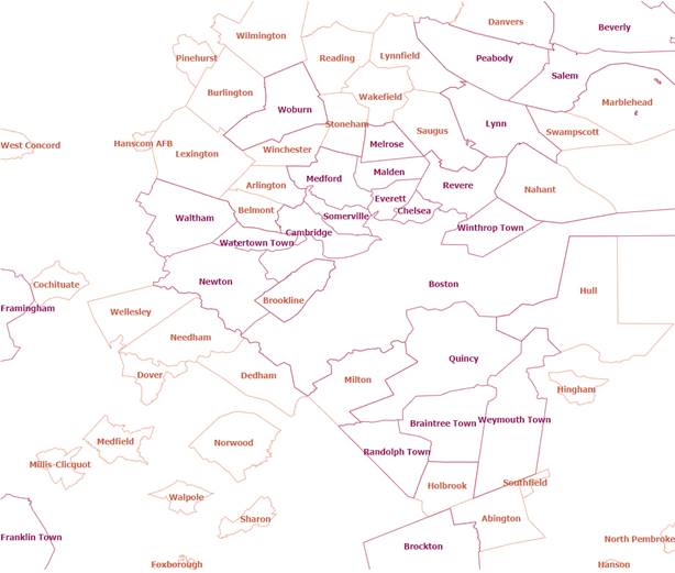
Browse
Graphic: https://tigerweb.geo.census.gov/arcgis/services/TIGERweb/tigerWMS_Current/MapServer/WmsServer?REQUEST=GetMap&SERVICE=WMS&VERSION=1.3.0&LAYERS=Census
Designated Places,Census
Designated Places Labels,Incorporated Places,Incorporated Places
Labels&STYLES=default,default,default,default&FORMAT=image/svg+xml&BGCOLOR=0xFFFFFF&TRANSPARENT=TRUE&CRS=EPSG:4326&BBOX=42.299053,-71.408142,42.35679,-70.798861&WIDTH=891&HEIGHT=751
Browse
Graphic Type: URL for the TigerWeb
Web Mapping Service
Browse
Graphic Caption: URL for the TigerWeb
Web Mapping Service
Citation:
Title: Series
Information File for the 2018 TIGER/Line Shapefile,
Current Place State-based
Alternate
Title: National Geospatial Data Asset (NGDA) Place
Date:
Date: 2018
Date
Type: Publication Date
Edition: 2018
Point Of Contact:
Representation
Type: Vector
Topic
Category: Administrative and Political Boundaries
Keyword
Collection:
Keyword: NGDA
Keyword: Governmental
Units and Administrative and Statistical Boundaries Theme
Keyword: National
Geospatial Data Asset
Associated
Thesaurus: NGDA Portfolio Themes
Keyword: State
or equivalent entity
Keyword: Polygon
Keyword: Census
Designated Place
Keyword: CDP
Keyword: City
Keyword: Village
Keyword: Town
Associated
Thesaurus: None
Keyword: U.S.
Keyword: United
States
Keyword: State or
Equivalent Entity
Associated
Thesaurus: ISO 3166 Codes for the representation of names of countries and
their subdivisions
Spatial
Extent:
West
Bounding Longitude: -179.231086
East
Bounding Longitude: 179.859681
North
Bounding Latitude: 71.441059
South Bounding
Latitude: -14.601813
Legal
Constraints:
Access
Constraints: Other Restrictions
Use
Constraints: Other Restrictions
Other
Constraints: Access Constraints: None
Distribution
Distribution
Format:
Format
Name: TGRSHP (compressed)
Format
Version:
File Decompression
Technique: The TIGER/Line shapefiles contain
geographic data only and do not include display mapping software or statistical
data. For information on how to use the TIGER/Line shapefile
data with specific software package users shall contact the company that
produced the software.
Distribution
Format:
Format
Name: HTML
Format
Version:
Transfer
Options:
URL: https://www2.census.gov/geo/tiger/TIGER2018/PLACE
Name:
Transfer
Options:
URL: https://www.census.gov/geo/maps-data/data/tiger-line.html
Name:
Description:
Transfer
Options:
URL: https://tigerweb.geo.census.gov/arcgis/services/TIGERweb/tigerWMS_Current/MapServer/WMSServer
Application
Profile:
Name:
Description:
Function: Download
Transfer
Options:
URL: https://tigerweb.geo.census.gov/arcgis/rest/services/TIGERweb/Places_CouSub_ConCity_SubMCD/MapServer
Application
Profile:
Name:
Description:
Function: Download
Transfer
Options:
Name:
Distributor:
Distributor
Contact: