
|
||
|
Home |
|
WV Spatial Data Infrastructure: Framework DataThe West Virginia GIS Technical Center (WVGISTC) periodically publishes a report on the availability and development of geospatial data specific to West Virginia. This report focuses on the best available, core geographic data sets that form the backbone or "Framework" for local, State, and National Spatial Data Infrastructures. West Virginia's Framework geographic layers consists of nine core themes (hydrography, transportation, orthoimagery, elevation, land ownership (cadastral), geodetic control, boundaries (governmental units), structures, geographic names) used by most GIS mapping applications at the state and local level, and targeted as National Map layers for future topographic map production. This report also includes six application-specific data themes (soils, geology, land cover, critical structures, flood hazards, economic development) built on top of the core Framework layers and USGS digital topographic maps, a commonly used base image reference layer.WV Base layers, November 2005 (PDF) - (Power Point) NSGIC National Ortho Initiative 2005 (PDF - 7.9 MB File) WV Spatial Data Infrastructure January 2004 Status Report (PDF) Framework Implementation of WVSAMB Project Data (Doc) - February, 2003 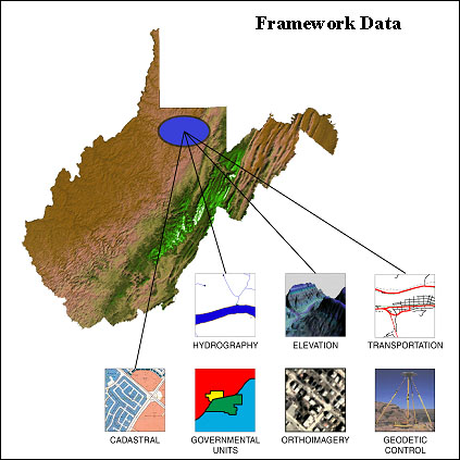
|
